28th April – Port Arthur and Maria Island (supposedly)
Because we cancelled our tour we slowly got up and organised, packed, fed, off we set. We thought we would drive to Port Arthur and have a look around. The weather has improved and though it is overcast, it is actually not raining. So we thought we would check and see if we could get another boat over to Maria Island. The timing will be quite tight.
Arriving in Triabunna Port, there is a bakery (not the Best Bakery, which was closed, hmmm, possibly not the best then) but another opposite. Jason is excited. But no scallop pies. He is cursed.
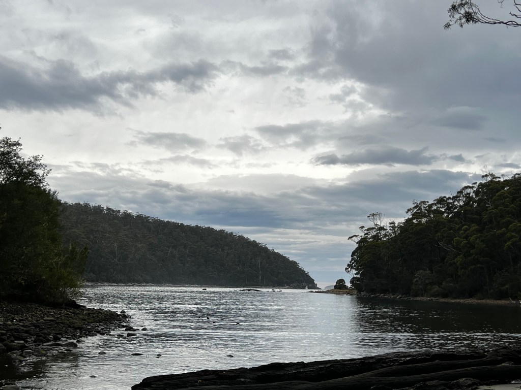
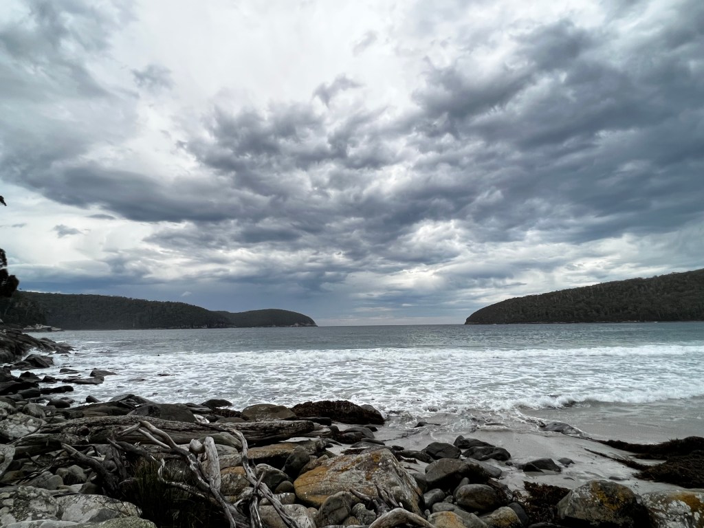
We head down to the Maria Island Encounter Centre. We can get on the next boat, yay, it is not raining, yay, I had already made our picnic lunch and snacks, we had all our warm gear with us, so why not. 30 minutes later we are on the ferry to Maria Island. Its not far but the sea is quite rough once you leave the harbour. Good fun really!
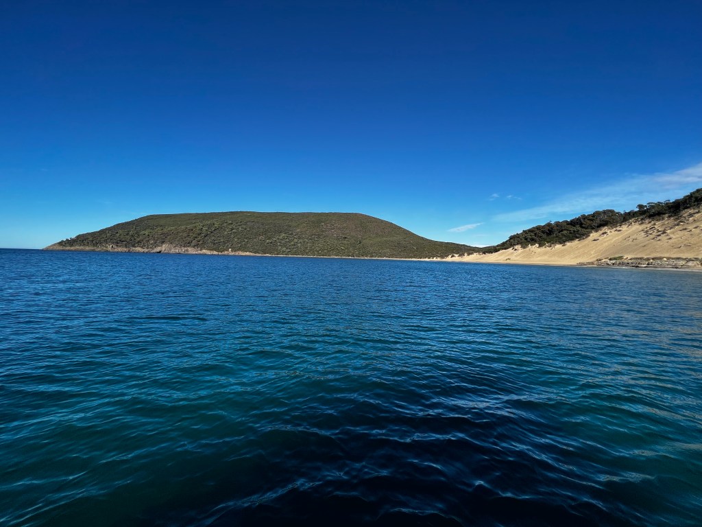
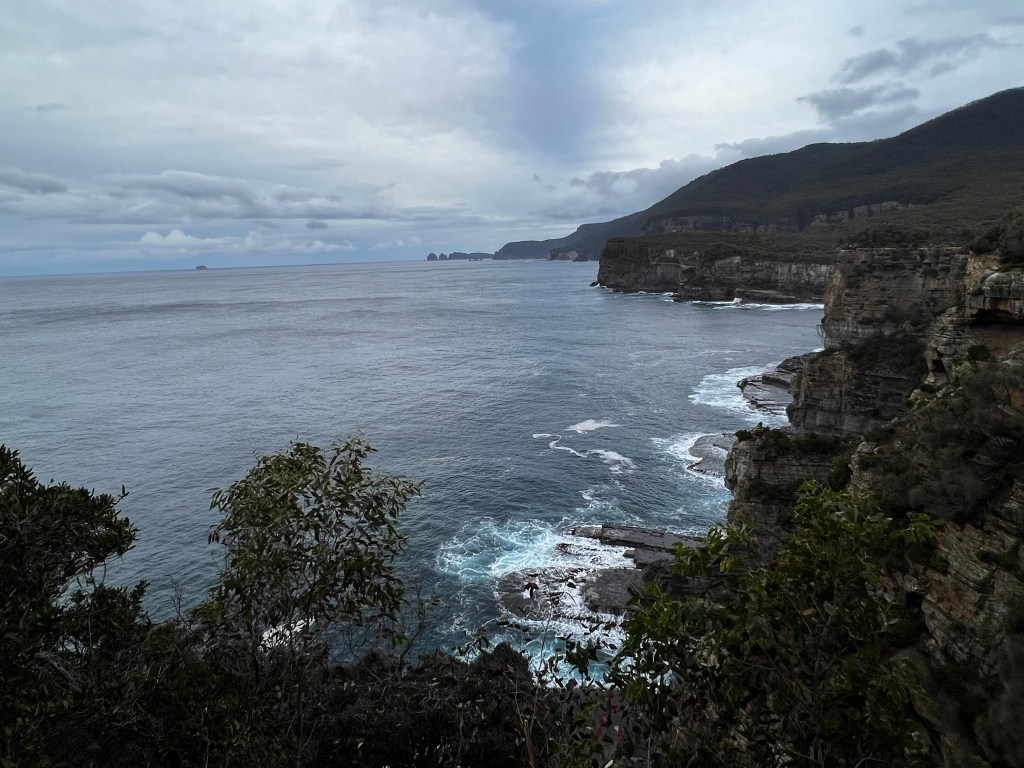
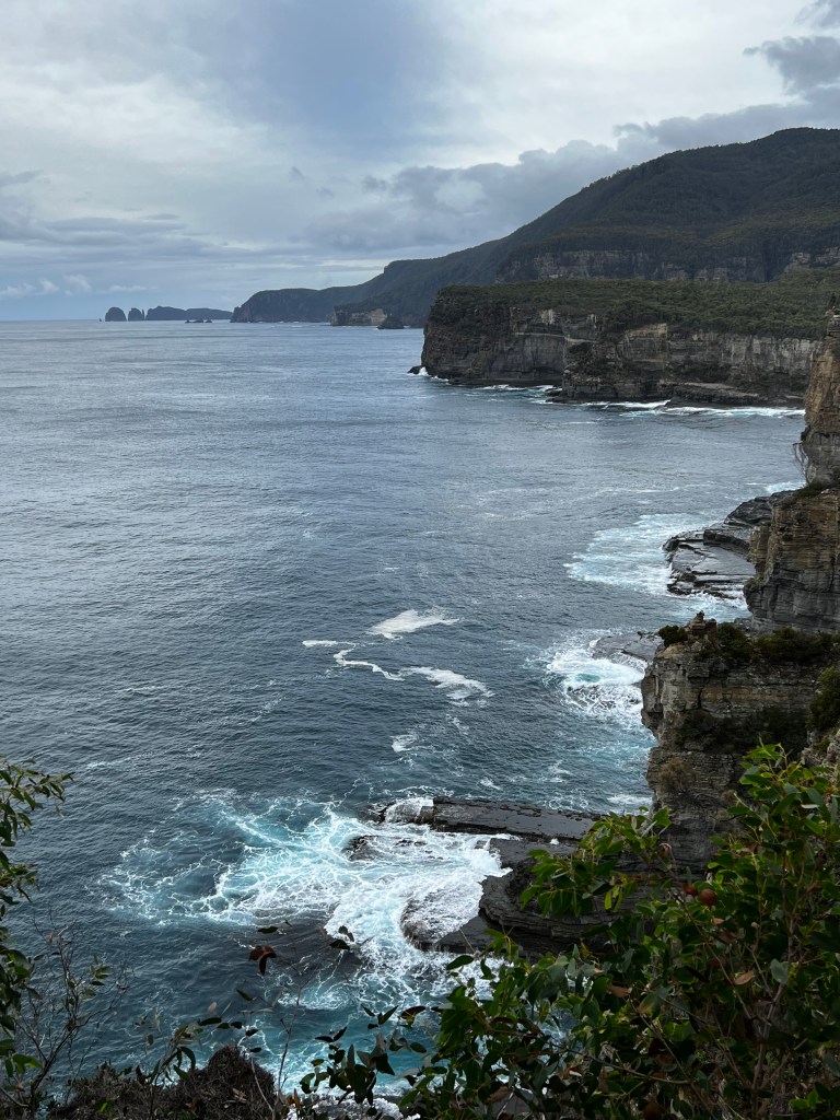
Catching sight of the mud we opt to leave the bikes and discover the island on foot. We spend the next 2.5 hours walking the beaches, inland, and cliffs. This place is magical.
AND
THERE
ARE
WOMBATS
So many wombats, I mean even the wombats had wombats. Within 5 minutes of disembarking the boat, there is one up on the hill, so I rush up to see it and take photos. I soon learn you do not even need to leave the path. They are everywhere and they are FLUFFY!
They just don’t care about people, too busy eating! You need to stay 2 meters away from them, but I swear you could get right next to them and as longas you were not in the way of their food they would not even notice you.
There are big fat wombats and baby wombats. I am in love.
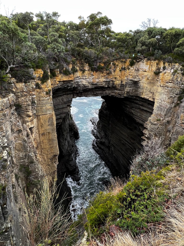
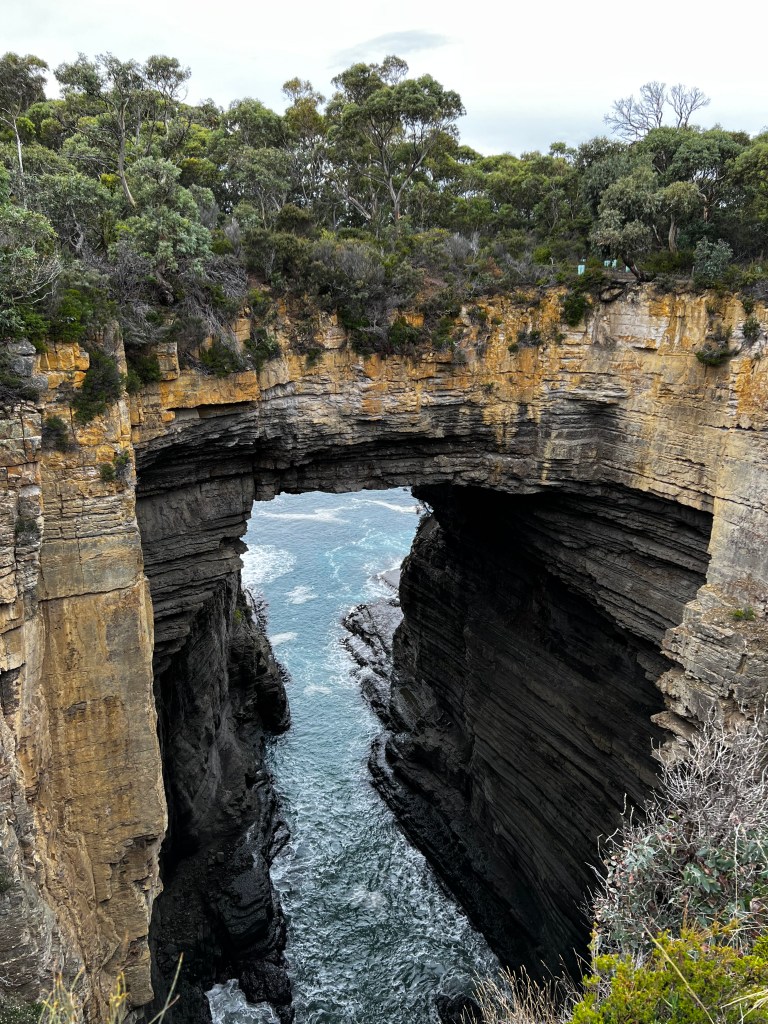
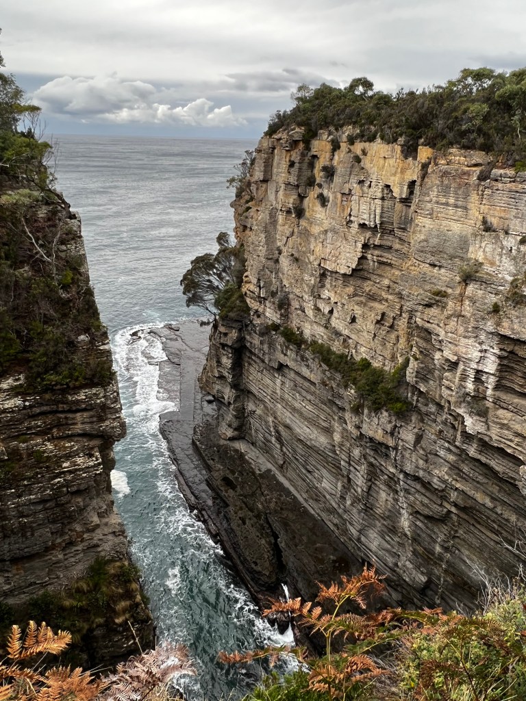
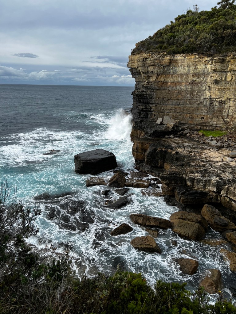
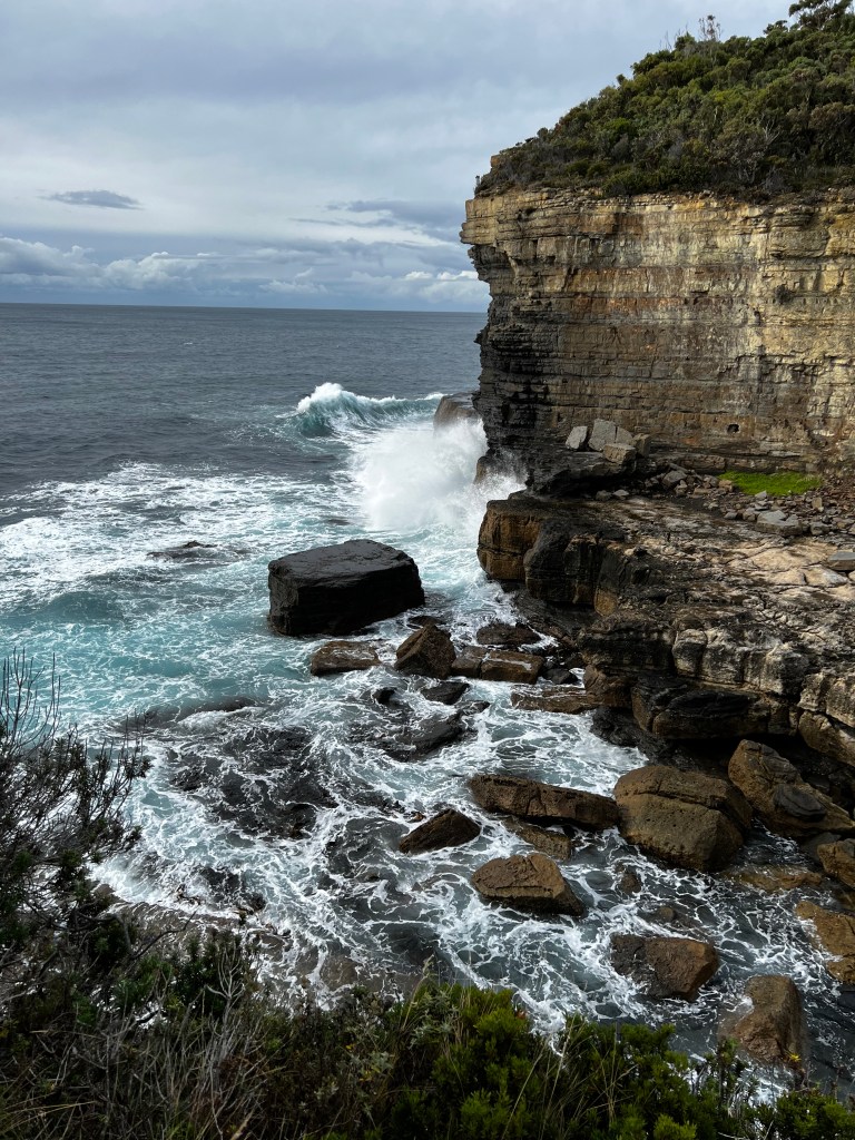
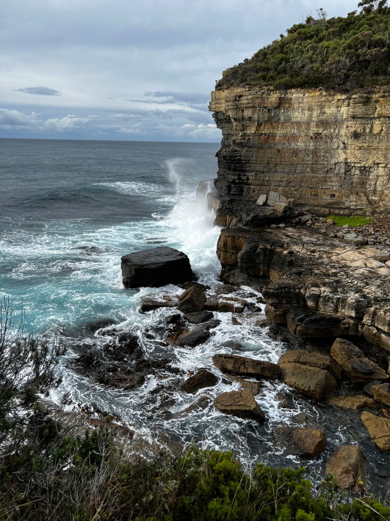
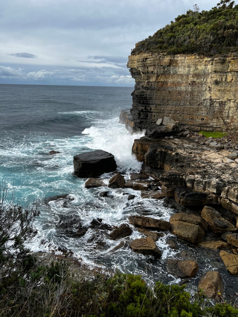
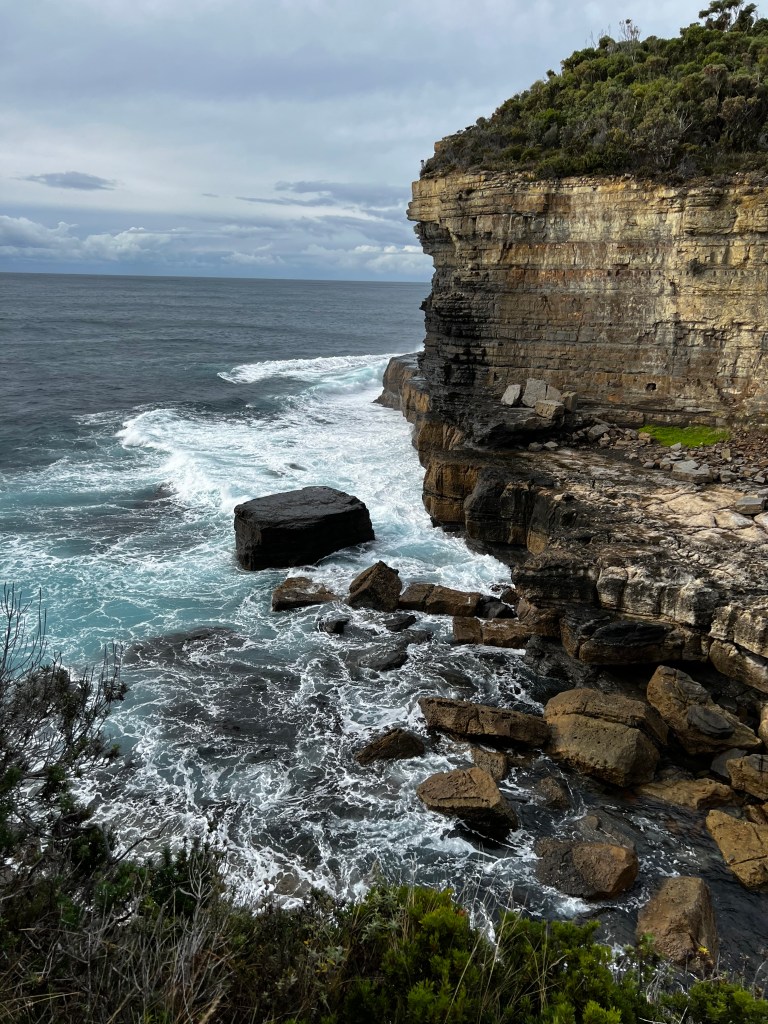
Oh and the scenery is lovely too. We walk to the painted cliffs. These aren’t exactly cliffs, and they are not really painted, but they are beautiful. The patterns are caused by ground water percolating down through the sandstone and staining the rock. Wave action and sea spray have continued the erosion, resulting in honeycomb patterns, potholes and notches. There are a bunch of students there, high school I think, so we don’t stay too long.
Our next walk is to Oast House, we have no idea what that is, but it looks like a nice walk. Turns out that an oast house (or hop kiln) is a building designed for kilning (drying) hops as part of the brewing process. In other words, we found Jason’s church. This building has been around since 1844, it has seen better days.
We still have time left and I would really like to see the fossil cliffs, if we really hoof it, and if I don’t stop to talk to every wombat, we should be able to do that part of the walk and make it back for our 230pm ferry.
The further we head to the East of the island we see less and less wombats (sadness) but we start to see lots of wallabies and then very large kangaroos. All lazing about on the open fields, which are being whipped up by a strong breeze off the water.
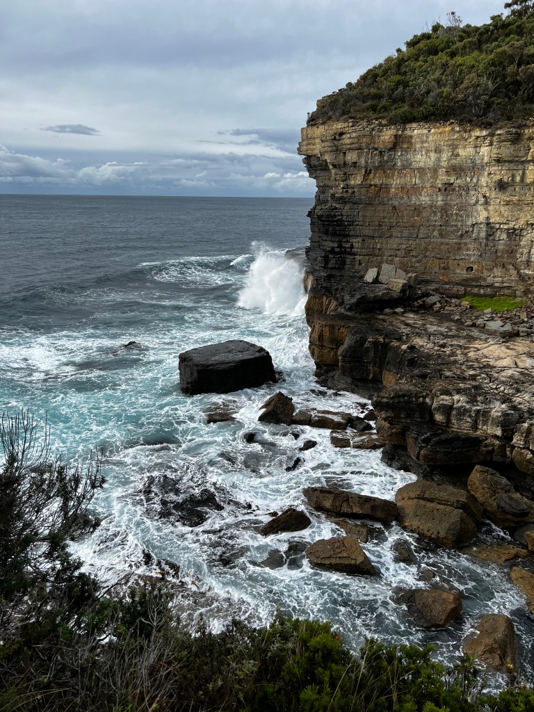
We make it out to the cliffs and they are terrifyingly steep, there is no health and safety guidelines here, just a sign telling you it’s a bloody long way down, so don’t be a dick! Well, I am paraphrasing, but you get the gist. Even Jason is being uncharacteristically sensible and staying away from the edge. Even now, typing about it, my stomach churns.
We have just enough time to get back to our ferry. I am so glad we decided to head to Maria Island it was well worth it, next time we shall go in the sunshine and do some of the larger hikes.
8.82km 175m elevation in 1 hour and 41 minutes
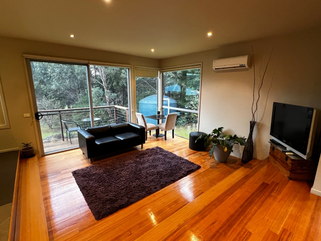
We are back at Triabunna by 315pm and checking into our accommodation in Port Arthur by 400pm. The accommodation is lovely and right near Little Norfolk Bay between the Port Arthur Historic Site and Eaglehawk Neck. It is so secluded and eerie here, the only sound is the passing traffic (not much).
The accommodation is lovely, so well equipped and toasty warm. We unload the car and start thinking about where to go for dinner. This is not a sprawling metropolis so our options are really limited. Without cell reception, and the internet does not work, the only thing we can do is drive and check. I mean, its not like its going to be busy right?
First stop, Fox and Hound – and we are proven wrong, they are fully booked oops! So we keep heading onwards. Next stop, Port Arthur Motor Lodge, the façade, dingy carpark, and VERY dodgy public bar (think Once Were Warriors), all had us thinking what have we done. But, once we found the door to the restaurant (obligingly provided by the toothless lady at the aforementioned bar) the staff were lovely, and the food was FABULOUS.
According to Jason, he had the best ribs he has ever eaten. I shall not take offence, I mean clearly he meant “the best ribs he had ever eaten, other than the ones I cook”.
In all seriousness it was beautiful food, lovely staff, very reasonable prices. If you find yourself hungry in Port Arthur, don’t let the public bar put you off the Port Arthur Motor Lodge.
Goodnight all.
Scallop pies – 0
Wombats – SO MANY FLUFFY WOMBATS
29th April – Port Arthur and Tasman Island
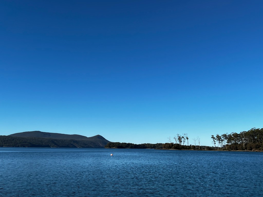
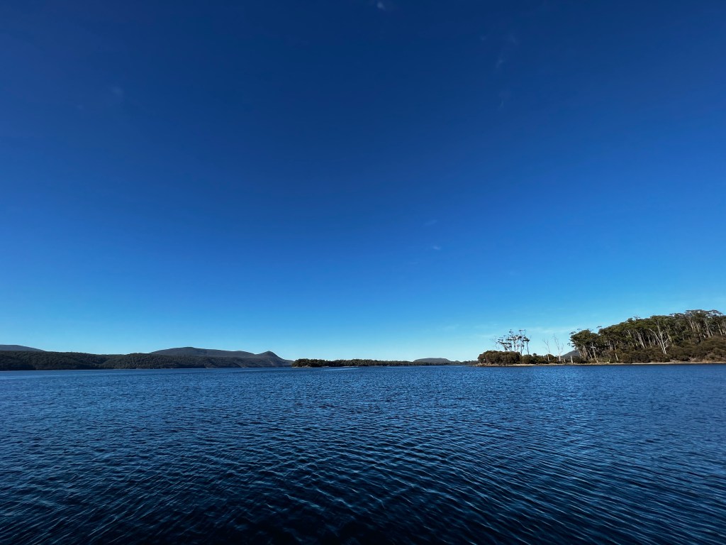
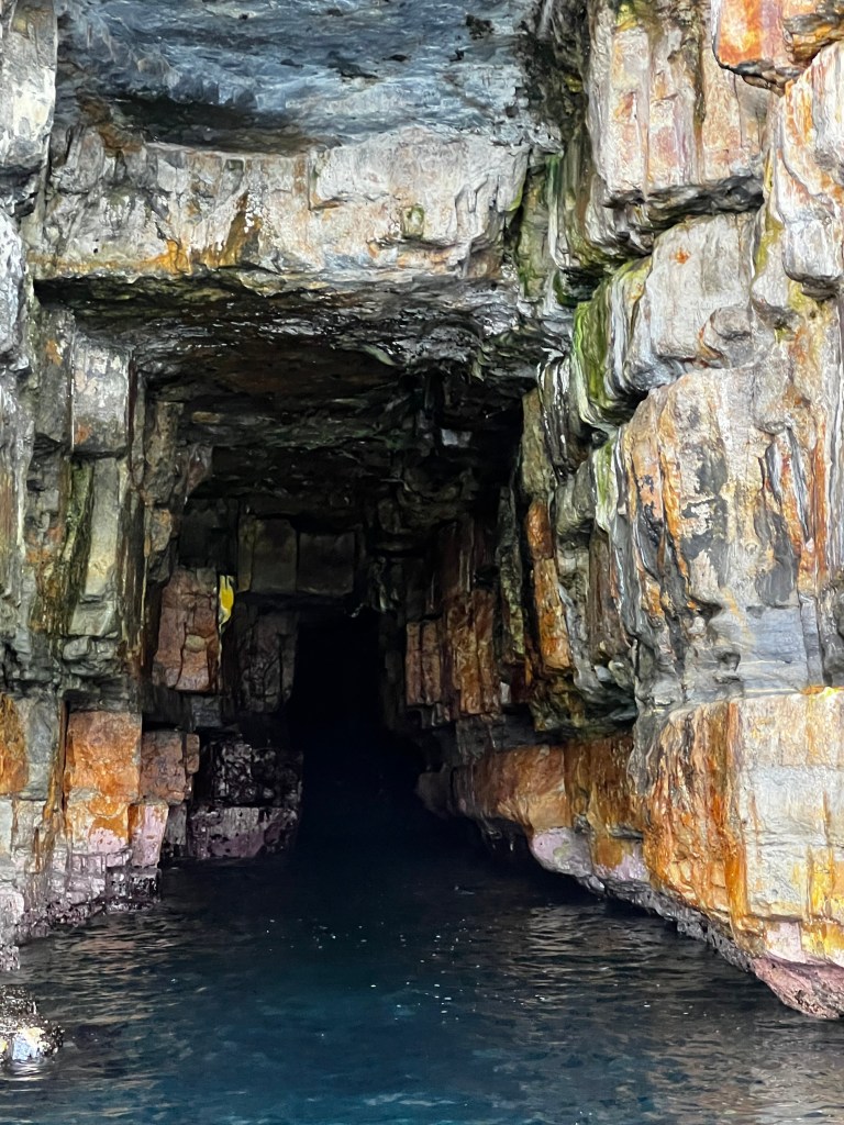
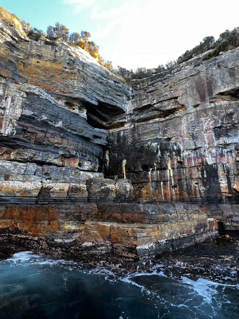
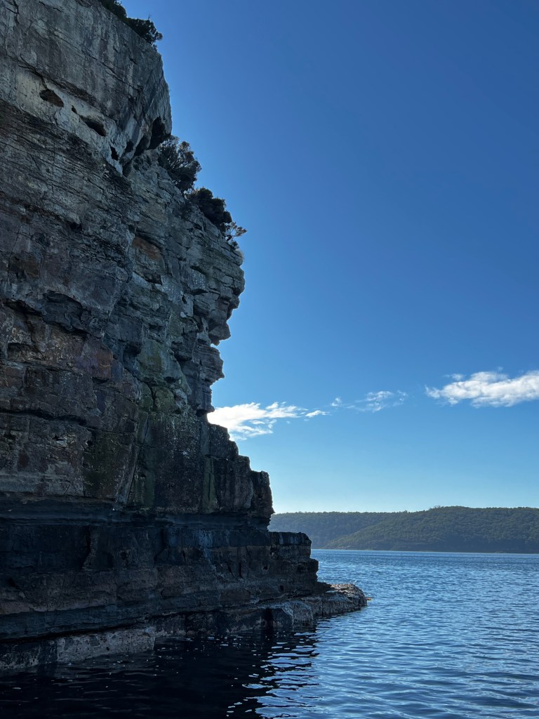
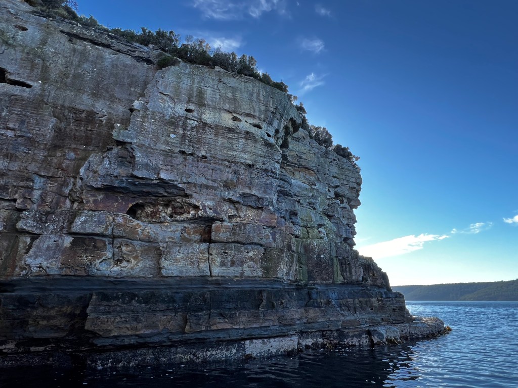
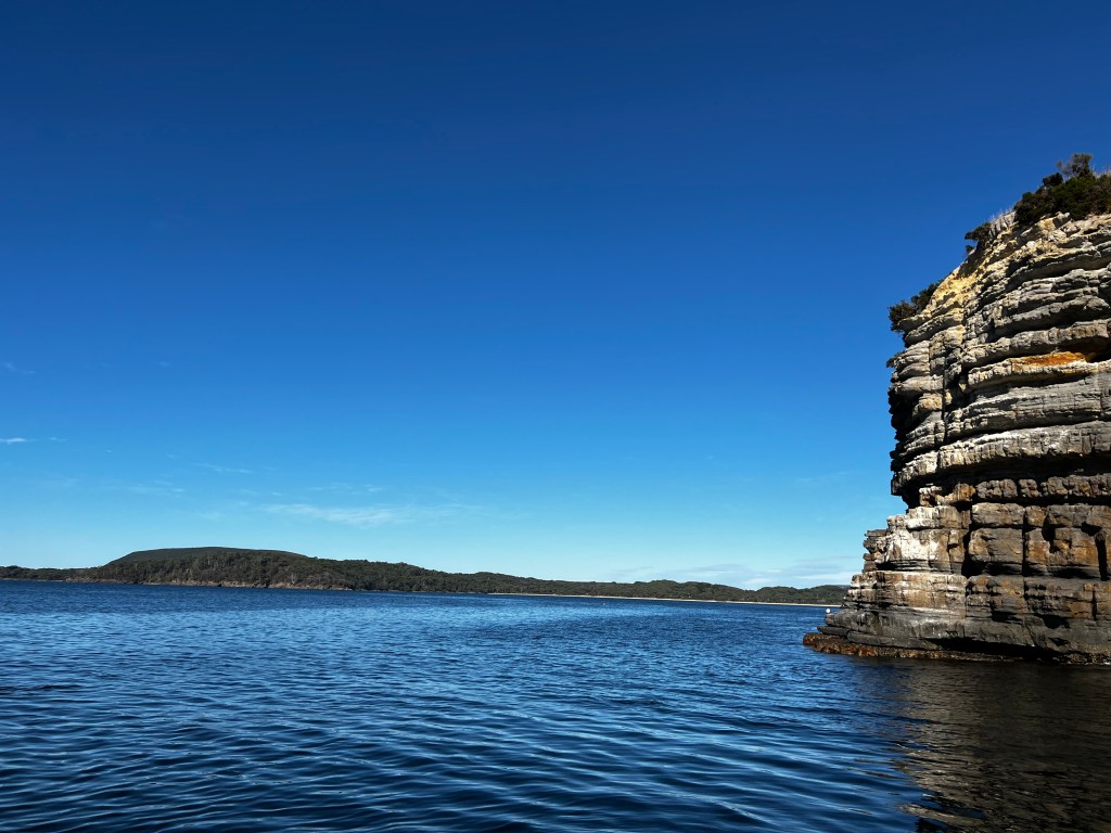
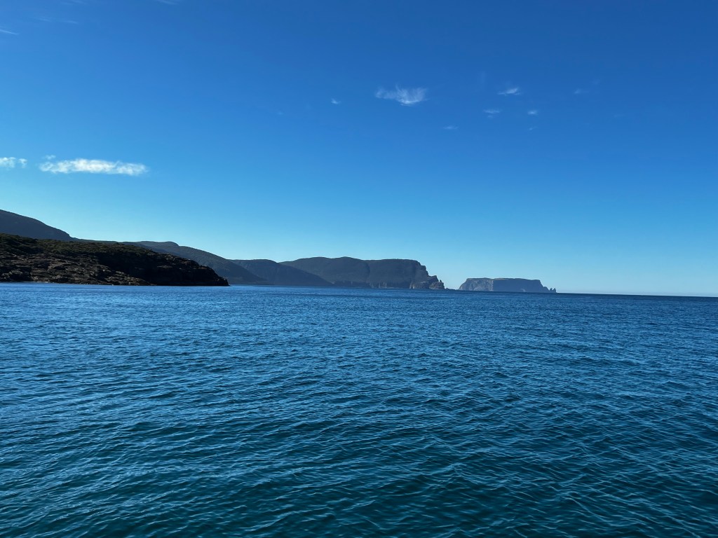
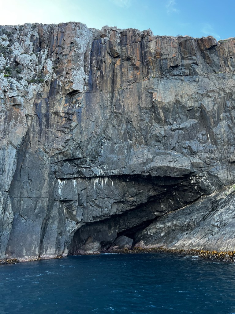
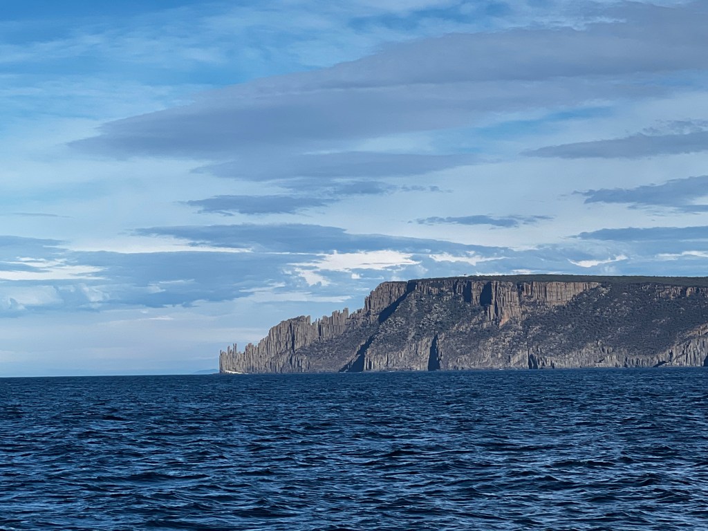
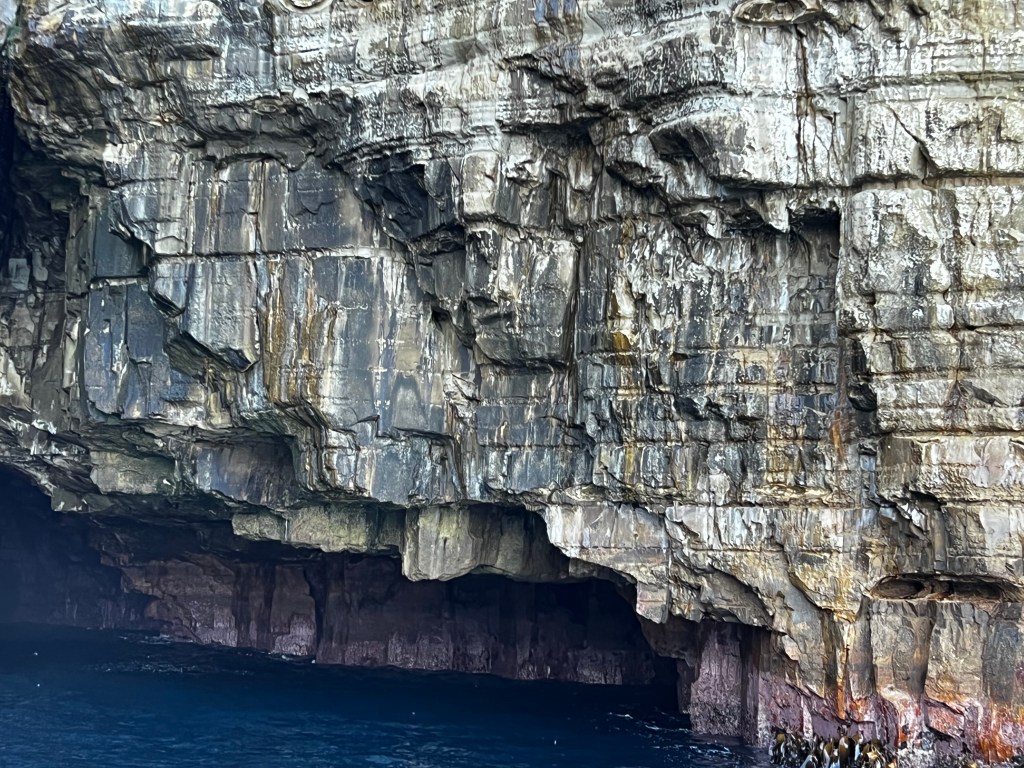
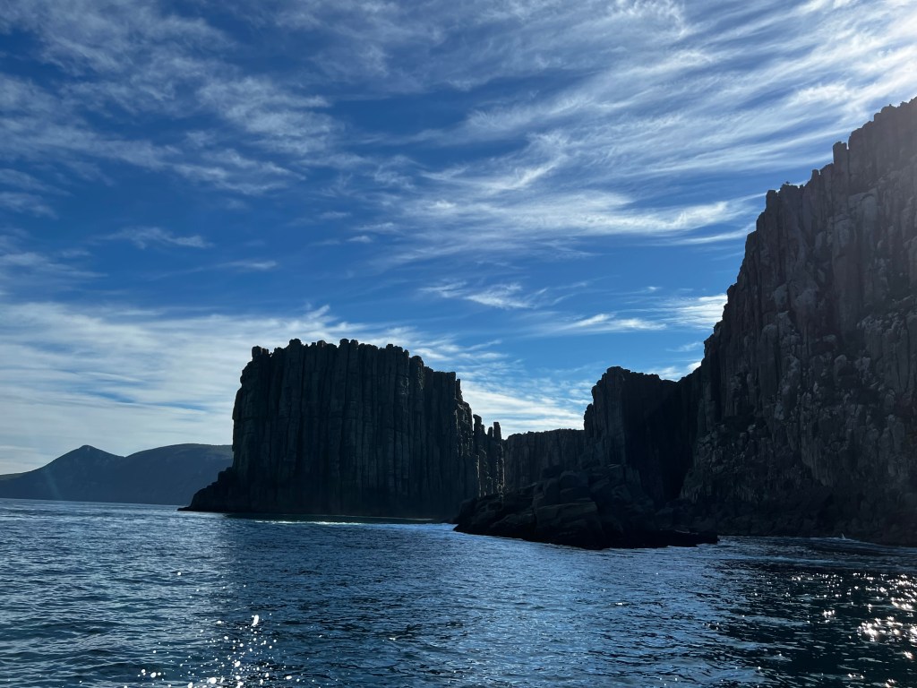
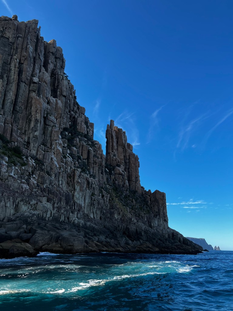
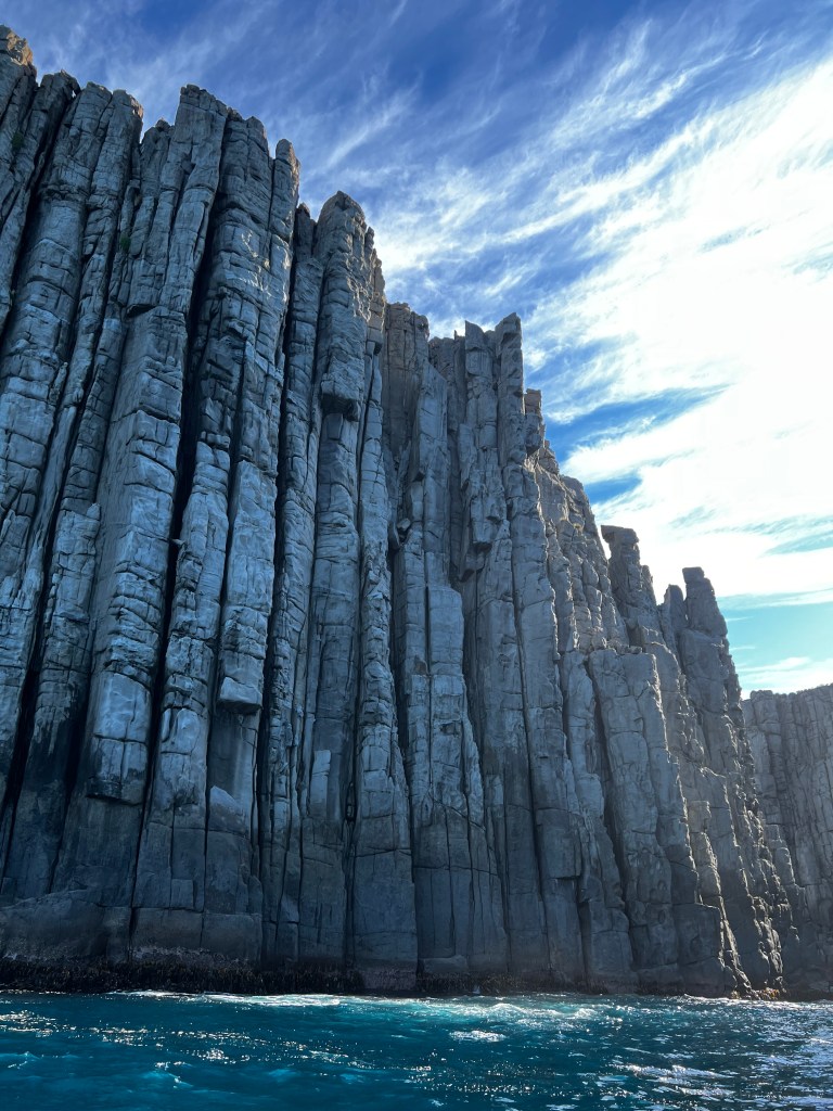
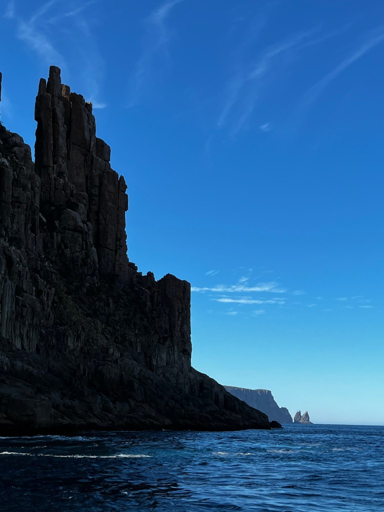
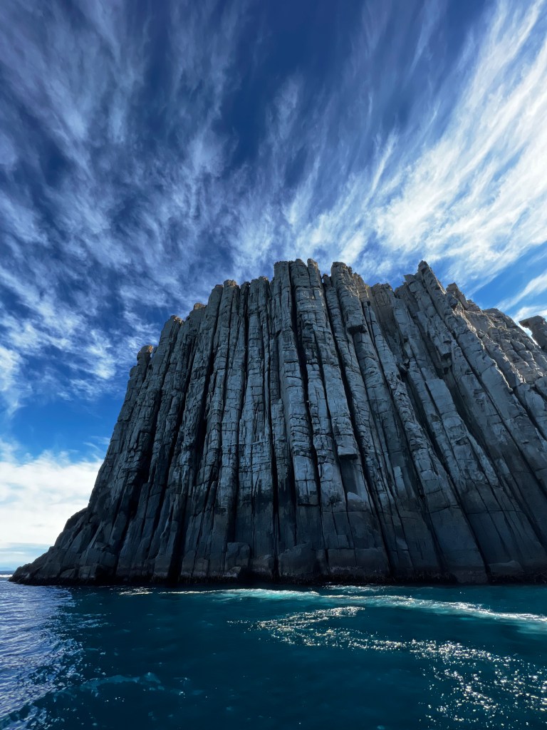
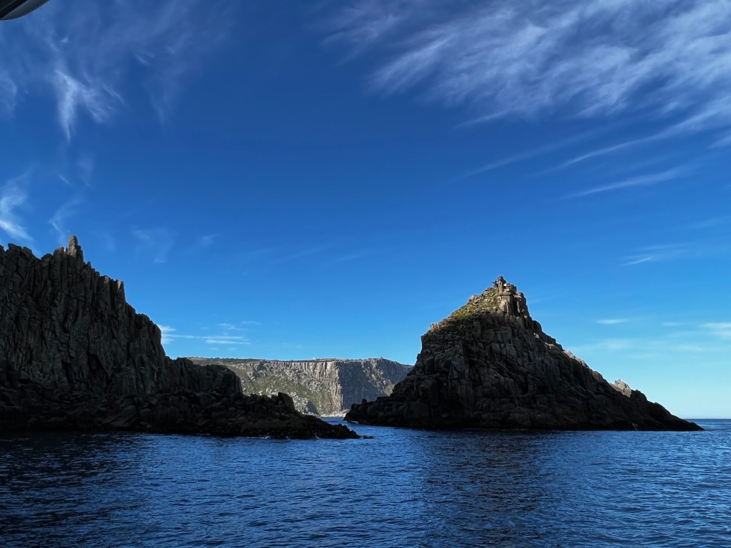
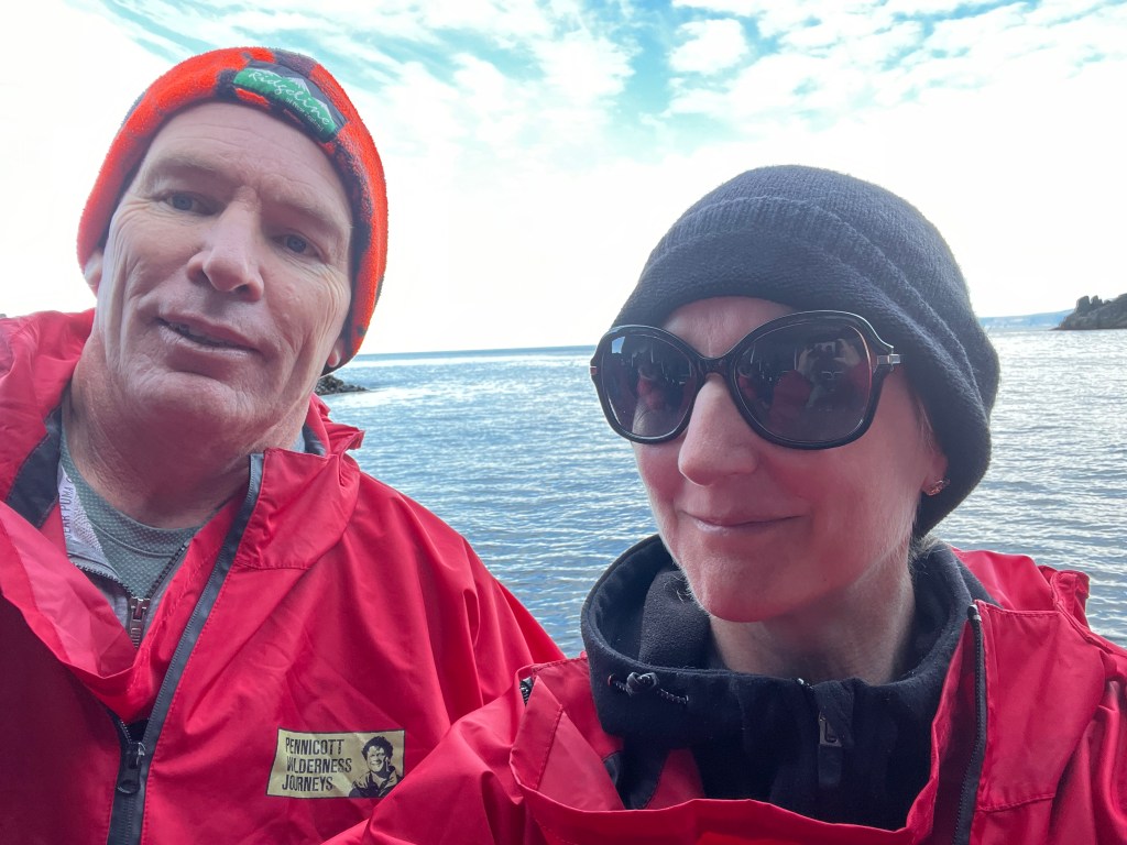
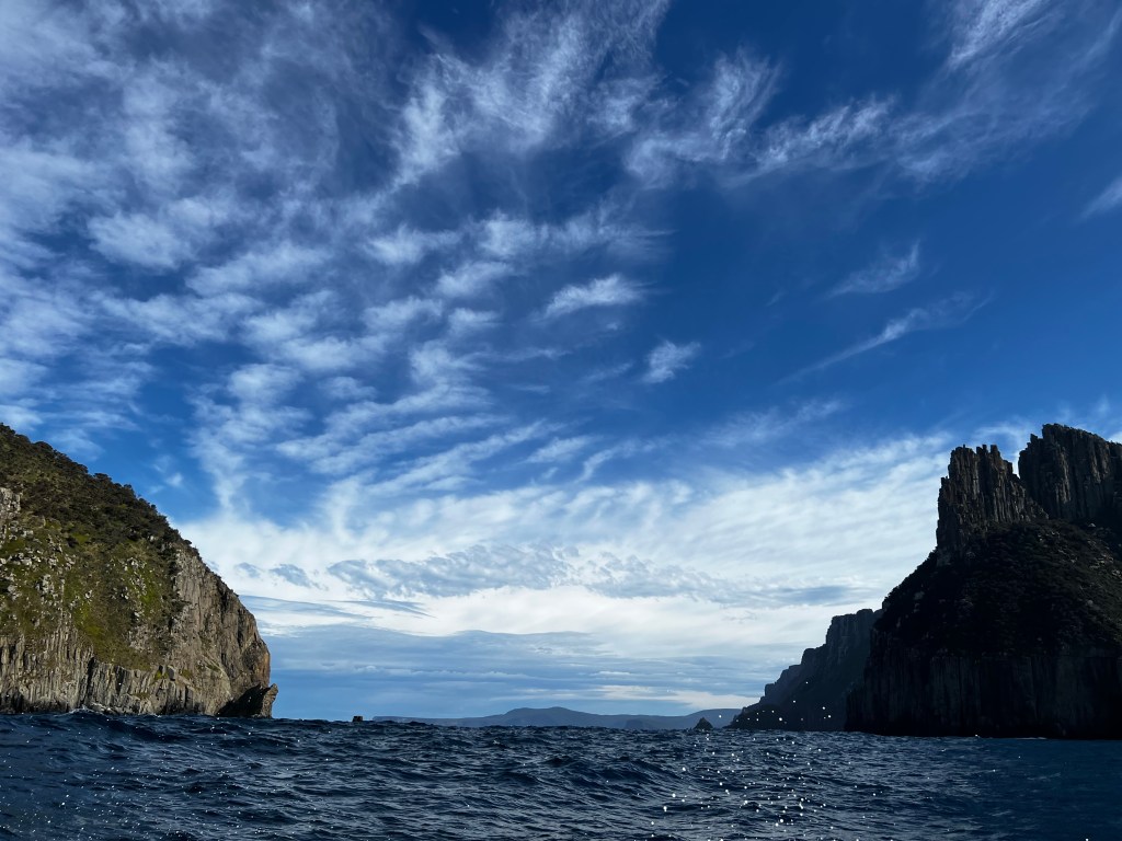
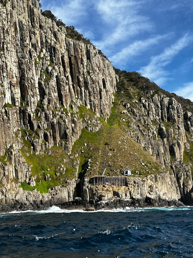
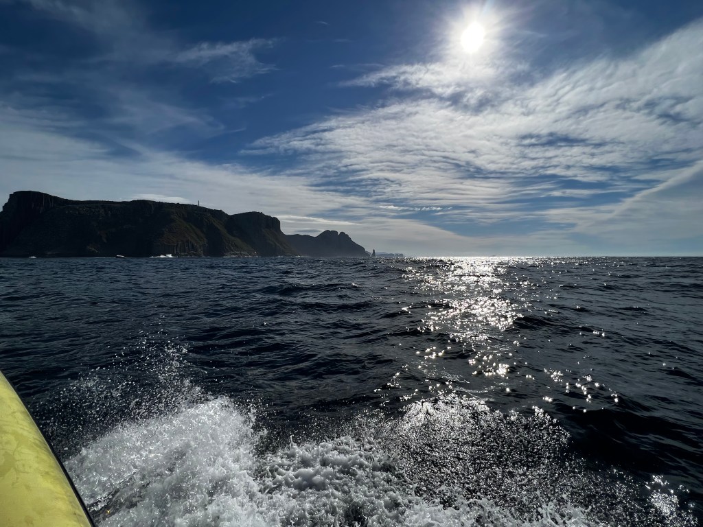
One of the tours I shuffled about was the Pennicott Wilderness tour to Tasman Island. A three hour cruise along the coastline between Port Arthur and Eaglehawk Neck. You travel beneath the highest vertical sea cliffs in the Southern Hemisphere at Cape Pillar. Explore waterfalls, rock formations, archways and deep-sea caves. And it is pretty freaking awesome. The coastline is part of the Tasman National Park.
We are all rugged up because the boats are all open, there is no where to hide from the cold and the wind.
They also supply you with monk like jackets to keep you protected from the elements. It was not that bad though, so we just kept them close.
Like all tours it is the tour guides that make it memorable, they have their little quips and jokes that get everyone laughing and talking. This time we have Nick and Hamish – they are so damn funny. The usual safety warnings.
How to put the life jacket on, the light in case you need it for reading whilst you are in the water, and if necessary blow the whistle three times, this replicates the elephant seal mating call and will ensure you are not lonely.
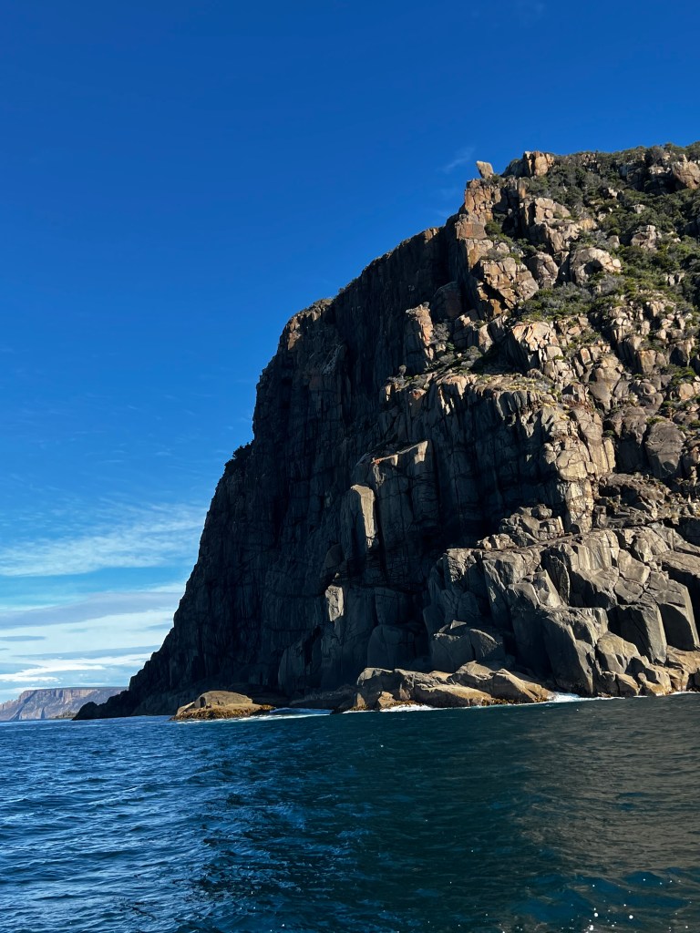
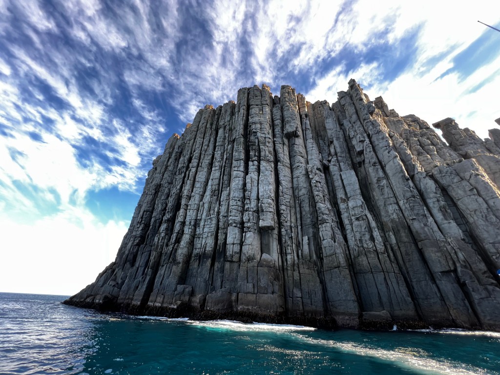
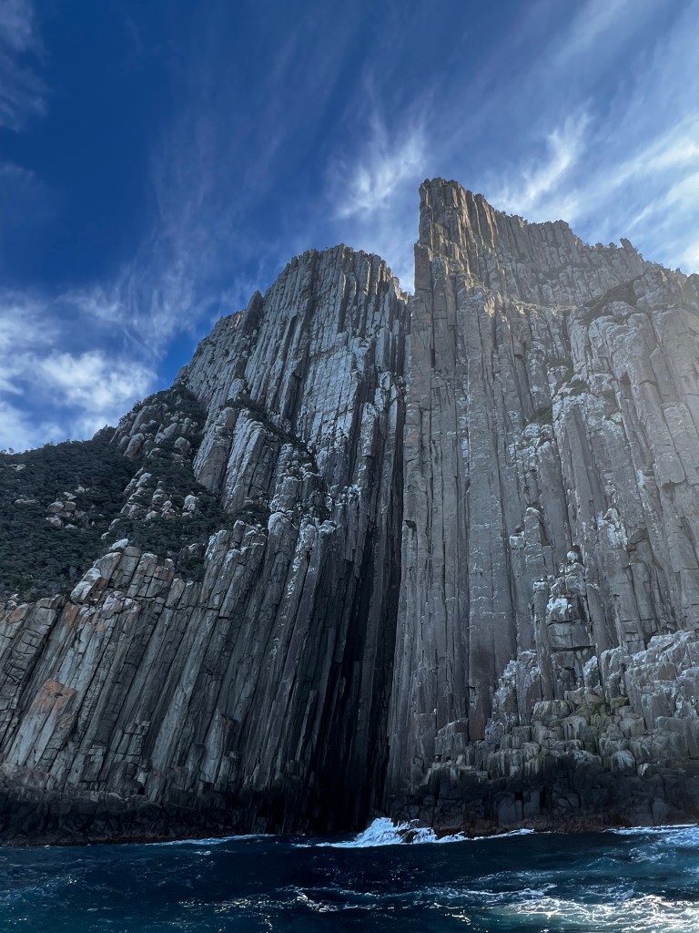
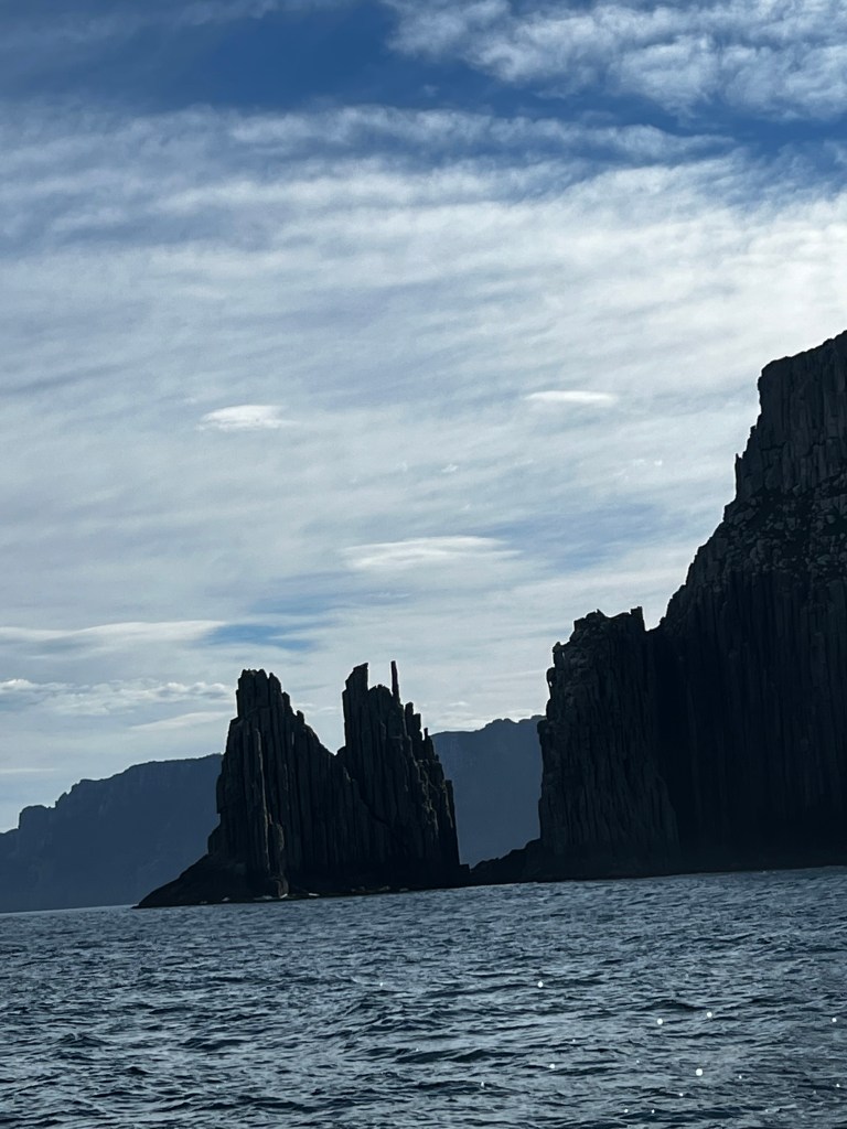
The boat can hoon man, 750 horse power and not a lot of weight to the boat. So when they throttle you really feel it. We visit a lot of caves and rock cliffs, the rock formations are amazing. Apparently in the 1950s the English Navy used them as target practice. What the ACTUAL fuck humans!
So, a bit of blurb the dolerite columns were formed during the Jurassic Period over 185 million years ago and pushed up to the surface in the last 10 million or so years. Even the power of the waves, and these waves are brutal, battering these columns for a long time and has not messed with their perfectly formed geometric columns. But yes, the Navy used Cape Raoul for target practice. Bastards, I like to think that mother nature had a little bit of pay back when an English sailor was eaten by a shark a short time later. You just have to hope that there is a little bit of karma in the world. Or as Nick called them, the grey taxman.
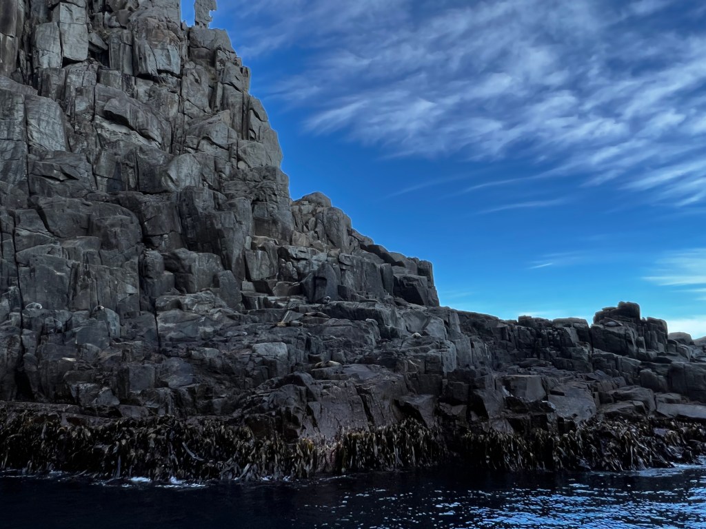
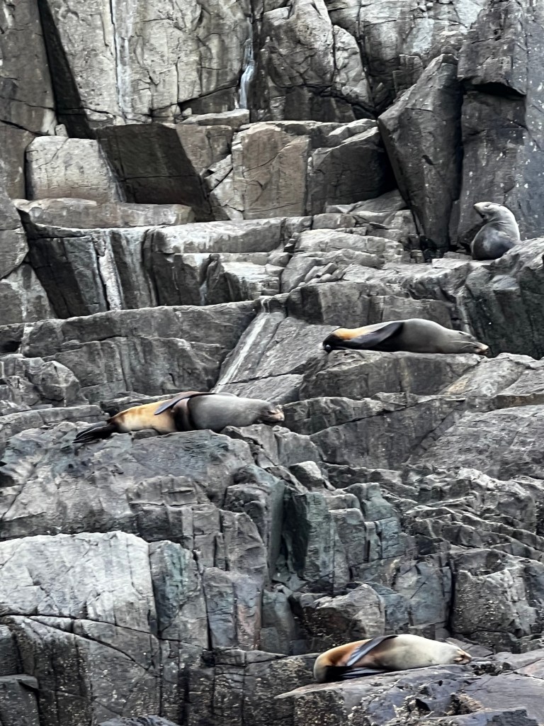
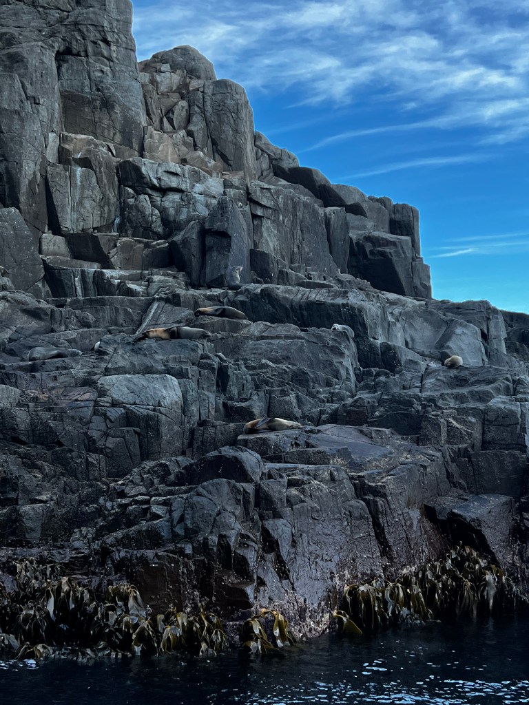
We visit a colony of brown fur seals, previously known as New Zealand fur seals, oh for the love of god how bad they smell. It does not matter which way the wind is blowing, you cannot escape the stench, it is rank! They are cute though. I think they look like sea staffies, like when you tell them off and they flatten their ears. Staffies of the sea, I like that.
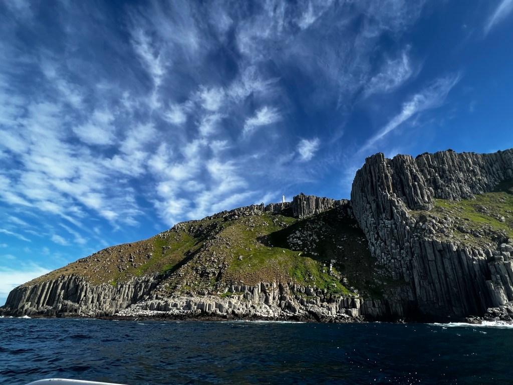
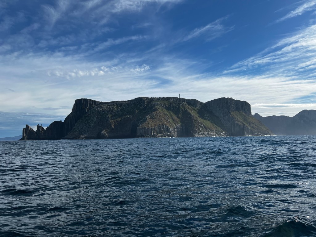
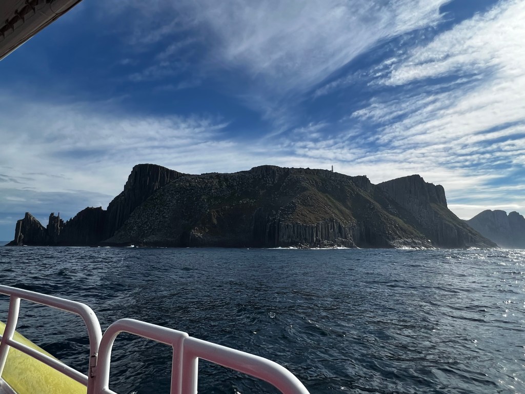
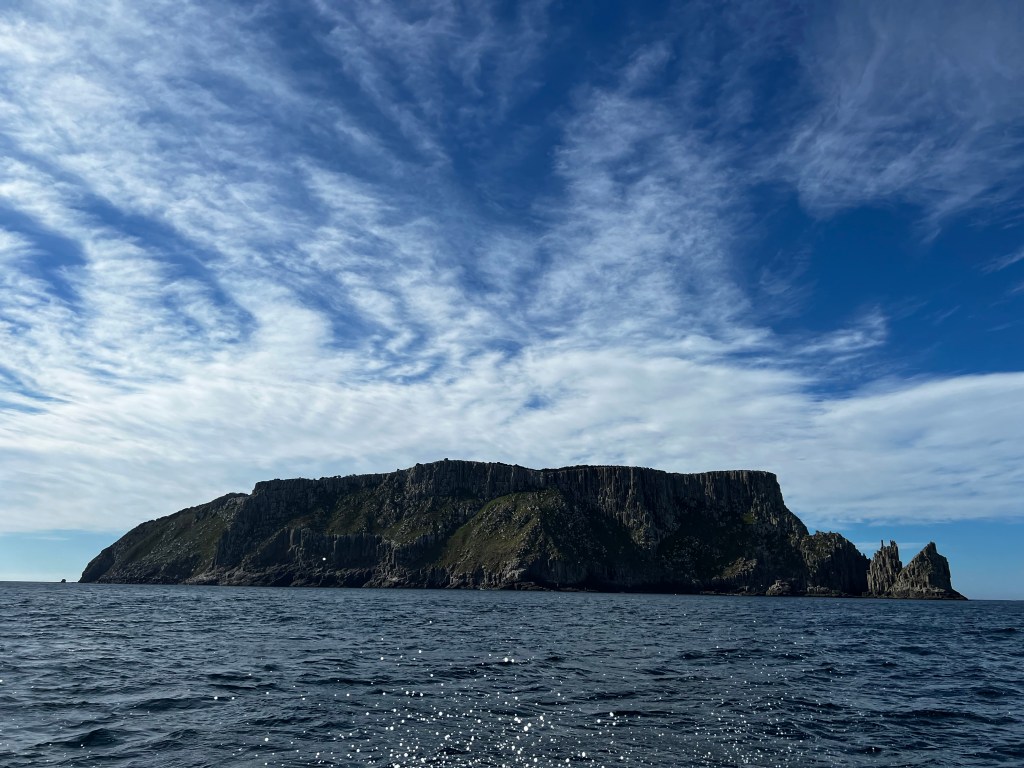
We then head out to Tasman Island. This place is rugged and people lived on it to take care of the lighthouse. It is an oval shaped island 1.2 square kilometres, close to the south-eastern coast of Tasmania, Australia. The island is in the Tasman Sea, situated off the Tasman Peninsula and is contained within the Tasman National Park.
On top of the island is one of Australia’s most inaccessible light stations, being posted there was so unpopular that it was likened to the infamous American island prison Alcatraz. No shit Sherlock!
The island is a plateau surrounded by steep dolerite cliffs, with its highest point 300 metres above sea level with an average height of 280 metres.
So keep that in mind, keep in mind how fucking far you would fall if you were not paying attention to your surroundings… then think about this… stores and people were taken from a landing stage and winched up the cliffs via a tramway and flying fox.
Every fortnight they would sail out with provisions for the lighthouse keeper and settlement. To get the provisions up the cliffs they built a winch that would be used to drag them up from the shore. No easy feat, it would be too hard for a human to drag them all the way up. So, they bring a horse over to the island.
Fucking seriously, on a small boat they sail over with Whisper the horse. I am sure he was very calm about that situation. And really, where did they get a life jacket to fit him? Then, for the rest of his natural life, he treks up and down the step cliff to bring up provisions.
Right up until the 1950s, the winch was still being operated by a horse. By then, three families lived on the island, with food supplies arriving by mailboat once a fortnight – if weather allowed. The light is still operational today but the settlement has long been abandoned and the Tasman Island Lighthouse and weather station have been automated since 1976 and unstaffed since 1977.
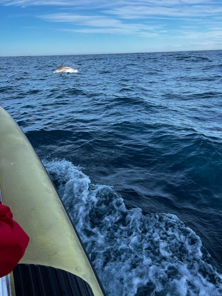
I had to look a lot of this information because the speel was interrupted by dolphins! Lots of them, all wanting to play around the boat, it was really cool, as dolphins are. So we cruised around and played with them for a while before heading back to shore. All in all a bloody awesome tour and I would highly recommend https://www.pennicottjourneys.com.au/
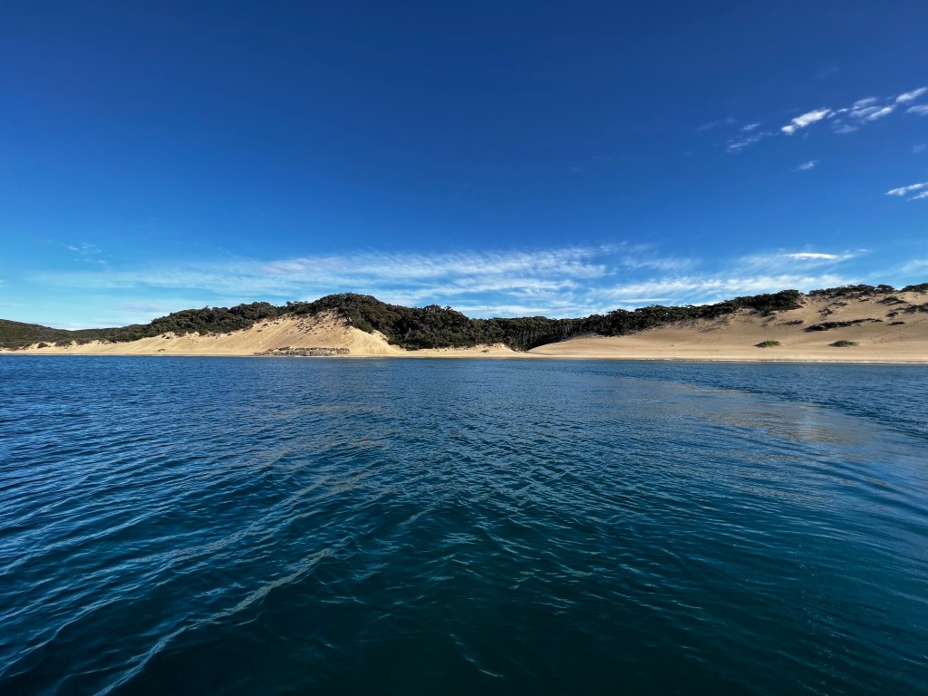
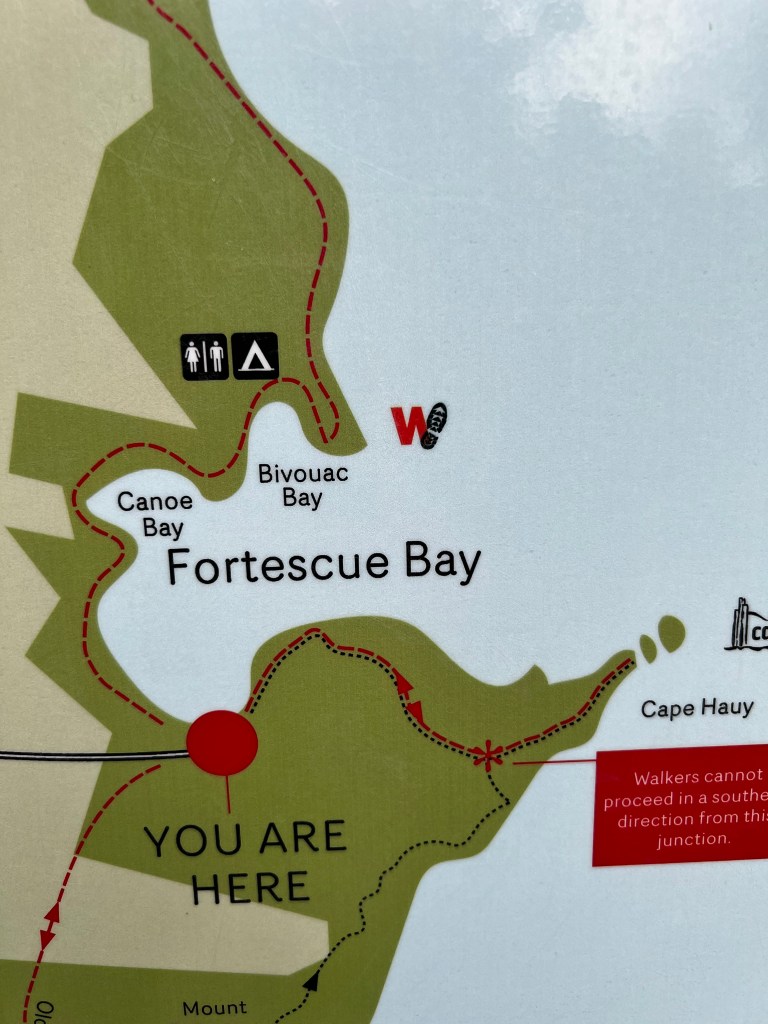
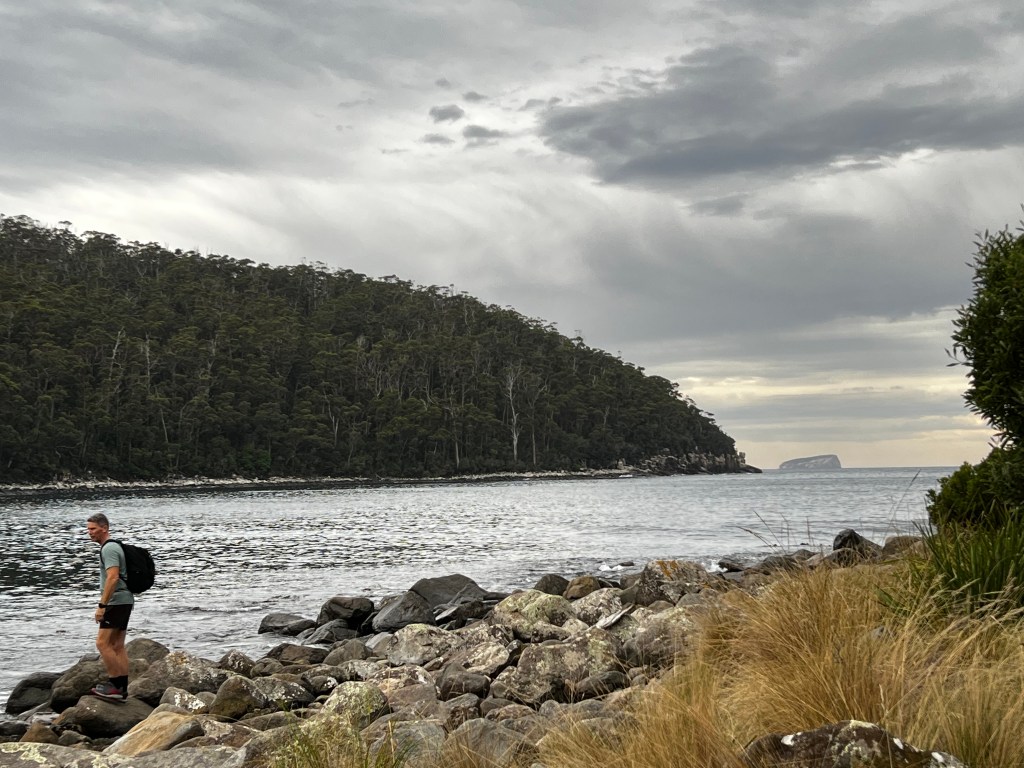
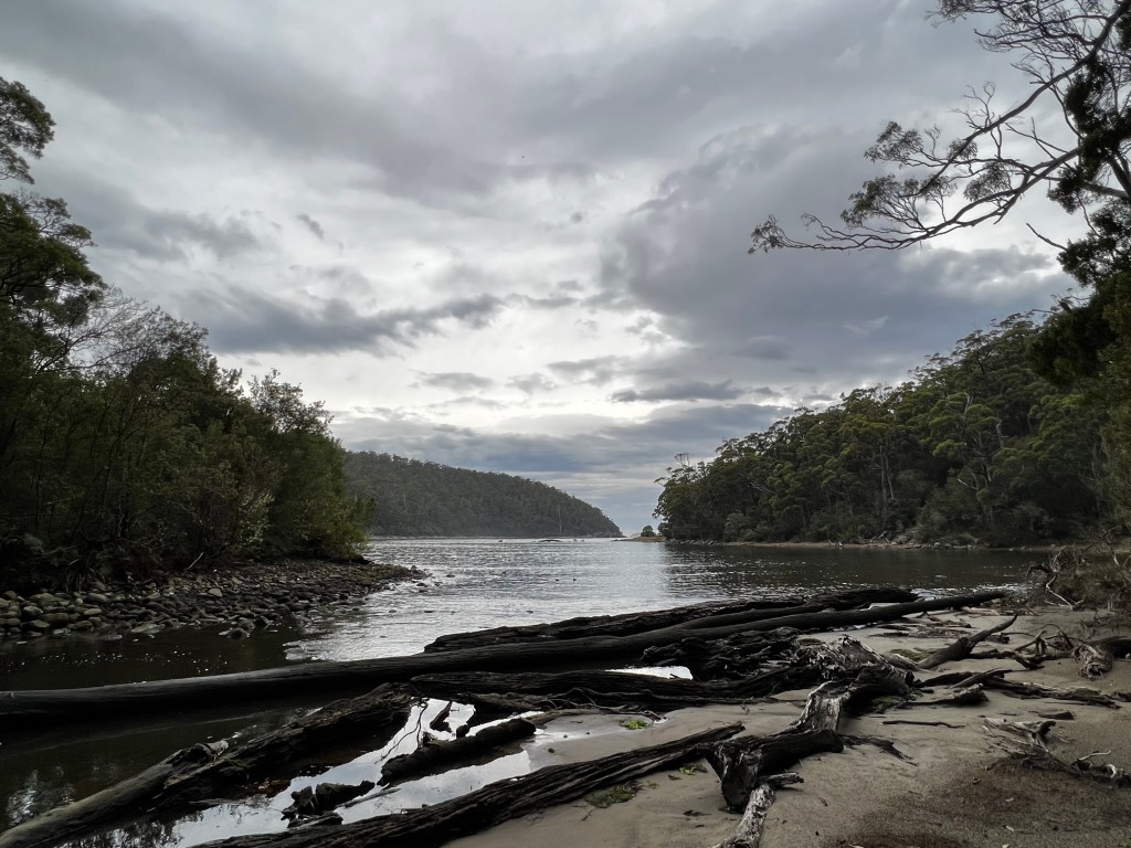
After a quick lunch to warm up, we wanted to get a quick hike in before it turned dark. Fortescue Bay was our only real option. 15kms on a dirt road riddled with potholes, poor little rental Corolla, we arrive at the beginning of our walk.
As it is getting late in the afternoon we decide we will head to Canoe Bay, it is only 2 hours return. As we are heading out at 200pm and we are likely to lose light at 530, it seems the smartest option. This is another walk where they give time estimates but nothing related to the actual distance, so we are winging it. Turns out the walk is really easy and we get to Canoe Bay in 45 minutes, so decide to push on to Bivouac Bay (some really creative naming happening here) this was a little harder and whilst the guide indicated it would only add another hour to our walk, we decided to turn back at 330, to ensure we were back on the beach by 500pm. It is such a cool forest, very much like home. We did not see any critters, even though one of the beaches was meant to be a rookery for penguins. No penguins were seen ☹
We make it back to the car as the sun sets and head back to our accommodation for a home cooked meal of fish. It was bloody tasty too.
Another peaceful night of sleep, tomorrow we drive to Hobart and meet up with Krys and David, hard to believe that we are halfway through our trip already.
Scallop pies – 0 eek